Newton Cap Bridge
Introduction
The photograph on this page of Newton Cap Bridge by Gordon Hatton as part of the Geograph project.
The Geograph project started in 2005 with the aim of publishing, organising and preserving representative images for every square kilometre of Great Britain, Ireland and the Isle of Man.

There are currently over 7.5m images from over 14,400 individuals and you can help contribute to the project by visiting https://www.geograph.org.uk
Newton Cap Bridge
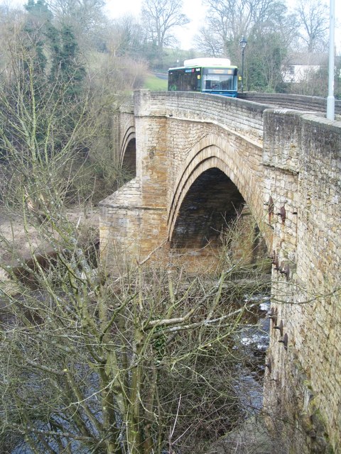
Image: © Gordon Hatton Taken: 13 Mar 2016
Medieval structure spanning the River Wear, and which for several centuries was the only way across the river from Bishop Auckland for road traffic. That situation changed in 1995 when the nearby Newton Cap railway viaduct was converted and opened to vehicles.
Images are licensed for reuse under creativecommons.org/licenses/by-sa/2.0
Image Location
Latitude
54.666915
Longitude
-1.683685