Housing off Brackenborough Road, Louth: aerial 2016
Introduction
The photograph on this page of Housing off Brackenborough Road, Louth: aerial 2016 by Chris as part of the Geograph project.
The Geograph project started in 2005 with the aim of publishing, organising and preserving representative images for every square kilometre of Great Britain, Ireland and the Isle of Man.

There are currently over 7.5m images from over 14,400 individuals and you can help contribute to the project by visiting https://www.geograph.org.uk
Housing off Brackenborough Road, Louth: aerial 2016
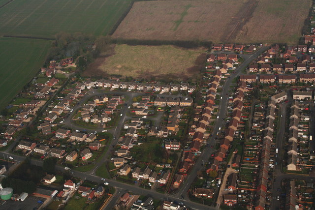
Image: © Chris Taken: 13 Mar 2016
140+ houses have been approved behind these, and now another 400 are proposed. The roads are narrow and crowded, and every house built at the top of the hill adds to the flooding problems for the houses at the bottom. We are told the country needs affordable housing. Of the 140+ houses in the first development, only 43 are to be affordable. If the ratio were the same for the second development, that would mean a total of 300 new executive houses. So...where are 300 new executives to come from in this little town in rural Lincolnshire? Having just defeated the dreadful "Southern Gateway" proposal of 970 houses on the other side of the town, Louth is faced with the misery and expense of yet another battle. See also Image
Images are licensed for reuse under creativecommons.org/licenses/by-sa/2.0
Image Location
Latitude
53.377131
Longitude
0.004934