Llangollen Canal south of Chirk Aqueduct, Shropshire
Introduction
The photograph on this page of Llangollen Canal south of Chirk Aqueduct, Shropshire by Roger D Kidd as part of the Geograph project.
The Geograph project started in 2005 with the aim of publishing, organising and preserving representative images for every square kilometre of Great Britain, Ireland and the Isle of Man.

There are currently over 7.5m images from over 14,400 individuals and you can help contribute to the project by visiting https://www.geograph.org.uk
Llangollen Canal south of Chirk Aqueduct, Shropshire
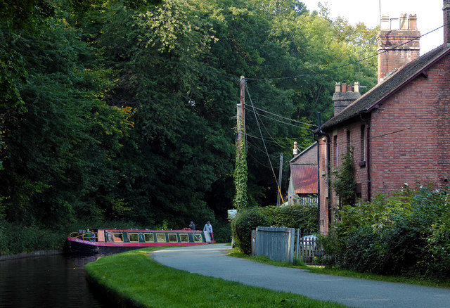
Image: © Roger D Kidd Taken: 19 Sep 2015
The narrowboat "Glas-y-Dorlan"* has crossed the aqueduct and is turning east past Aqueduct Cottages. *The Vale of Llangollen Canal Boat Trust is a registered charity and was formed in 1983 to raise money to build a narrowboat to provide day trips for disabled and disadvantaged people of all ages. http://www.vlcbt.org.uk/ The Llangollen Canal links Hurleston Junction (Shropshire Union Canal) to Llantysilio via Wrenbury, Whitchurch, Ellesmere, Chirk, Trevor, and Llangollen, a distance of 46 miles (74 kilometres). There are 21 locks.
Images are licensed for reuse under creativecommons.org/licenses/by-sa/2.0
Image Location
Latitude
52.926921
Longitude
-3.061326