Deja Vecu - Barton Arcade
Introduction
The photograph on this page of Deja Vecu - Barton Arcade by Anthony O'Neil as part of the Geograph project.
The Geograph project started in 2005 with the aim of publishing, organising and preserving representative images for every square kilometre of Great Britain, Ireland and the Isle of Man.

There are currently over 7.5m images from over 14,400 individuals and you can help contribute to the project by visiting https://www.geograph.org.uk
Deja Vecu - Barton Arcade
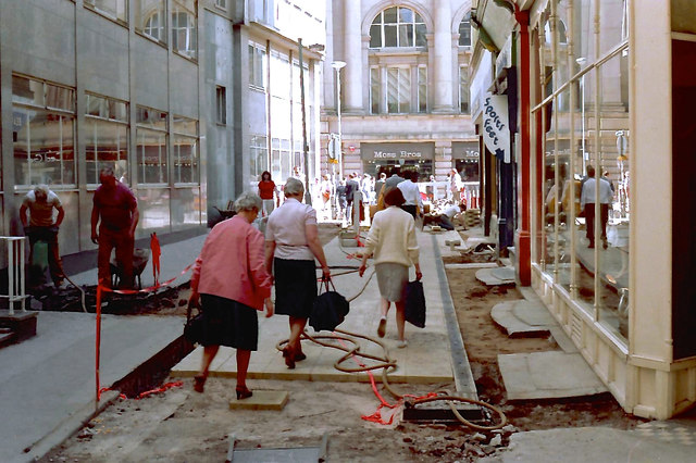
Image: © Anthony O'Neil Taken: Unknown
Older residents of Manchester, seeing the present repaving bonanza occasioned by extensions to the Metrolink tram system, would be right to think they had experienced it all before: not once but twice. Here, in 1984, in the environs of St Ann's Square, we see the Council's first attempt at improvements: to be followed, a decade later, by a further upgrade of the whole area. (See other (1994) photos on GEOGRAPH.)
Images are licensed for reuse under creativecommons.org/licenses/by-sa/2.0
Image Location
Latitude
53.482606
Longitude
-2.245887