Boundary marker and houses, Magdalen Road, Exeter
Introduction
The photograph on this page of Boundary marker and houses, Magdalen Road, Exeter by David Smith as part of the Geograph project.
The Geograph project started in 2005 with the aim of publishing, organising and preserving representative images for every square kilometre of Great Britain, Ireland and the Isle of Man.

There are currently over 7.5m images from over 14,400 individuals and you can help contribute to the project by visiting https://www.geograph.org.uk
Boundary marker and houses, Magdalen Road, Exeter
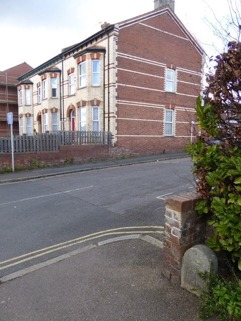
Image: © David Smith Taken: 4 Mar 2016
This stone marked where the boundary of the city and municipality reached Magdalen Road from the north, and then followed the road to the west (as marked on the 1880-1890 OS map). On the wall alongside is a benchmark (described on the Bench Mark Database at http://www.bench-marks.org.uk/bm40171) Image
Images are licensed for reuse under creativecommons.org/licenses/by-sa/2.0
Image Location
Latitude
50.721063
Longitude
-3.51787