Construction of Islwyn High School, March 2016
Introduction
The photograph on this page of Construction of Islwyn High School, March 2016 by M J Roscoe as part of the Geograph project.
The Geograph project started in 2005 with the aim of publishing, organising and preserving representative images for every square kilometre of Great Britain, Ireland and the Isle of Man.

There are currently over 7.5m images from over 14,400 individuals and you can help contribute to the project by visiting https://www.geograph.org.uk
Construction of Islwyn High School, March 2016
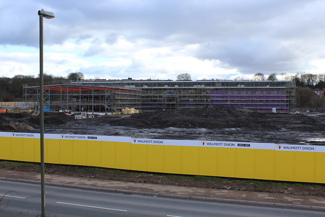
Image: © M J Roscoe Taken: 5 Mar 2016
The roof appears to be largely complete now; for an earlier view in January, see Image The future sports hall is on the left. The school is now due to open in 2017; see also www.islwynhigh.org. The road Waterloo is in the foreground, also built on the plateau of colliery waste filling much of a small valley.
Images are licensed for reuse under creativecommons.org/licenses/by-sa/2.0
Image Location
Latitude
51.6843
Longitude
-3.177532