Crossways House
Introduction
The photograph on this page of Crossways House by Derek Harper as part of the Geograph project.
The Geograph project started in 2005 with the aim of publishing, organising and preserving representative images for every square kilometre of Great Britain, Ireland and the Isle of Man.

There are currently over 7.5m images from over 14,400 individuals and you can help contribute to the project by visiting https://www.geograph.org.uk
Crossways House
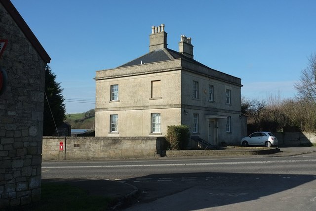
Image: © Derek Harper Taken: 16 Feb 2016
The former Crossways Inn https://www.historicengland.org.uk/listing/the-list/list-entry/1129517 at a crossroads on the A367. It's possible that the building to the left of the camera is the stable referred to at http://www.bathnes.gov.uk/sites/default/files/world_heritage_site_setting_study_rev4_current_22-10-09_web_version_part_3.pdf as "a stable near the summit of the hill, opposite the former Crossways Inn, which until the 20th century provided trace horses to assist with heavy loads in the ascent" (ie from the Cam brook valley on the Wells to Bath road). The Elizabeth II postbox is number BA2 113.
Images are licensed for reuse under creativecommons.org/licenses/by-sa/2.0
Image Location
Latitude
51.343782
Longitude
-2.405253