Kirkbride Church
Introduction
The photograph on this page of Kirkbride Church by Mary and Angus Hogg as part of the Geograph project.
The Geograph project started in 2005 with the aim of publishing, organising and preserving representative images for every square kilometre of Great Britain, Ireland and the Isle of Man.

There are currently over 7.5m images from over 14,400 individuals and you can help contribute to the project by visiting https://www.geograph.org.uk
Kirkbride Church
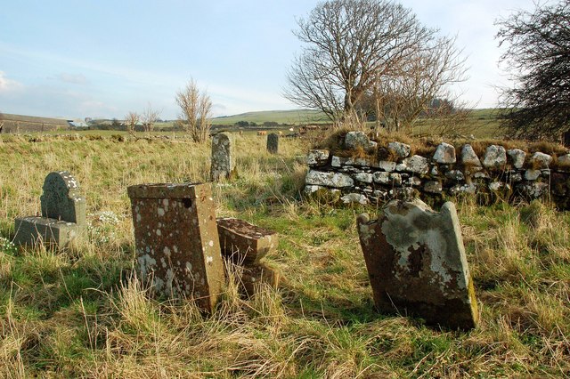
Image: © Mary and Angus Hogg Taken: 27 Feb 2016
The church of St Bridget existed here around 1185 when the parish was granted to the nuns of North Berwick. The parish was united with Maybole soon after 1571. The last burial was in 1913. The site contains a few ruins of the building and some stones that are difficult to decipher.
Images are licensed for reuse under creativecommons.org/licenses/by-sa/2.0
Image Location
Latitude
55.406332
Longitude
-4.74598