Douping Stone
Introduction
The photograph on this page of Douping Stone by Anne Burgess as part of the Geograph project.
The Geograph project started in 2005 with the aim of publishing, organising and preserving representative images for every square kilometre of Great Britain, Ireland and the Isle of Man.

There are currently over 7.5m images from over 14,400 individuals and you can help contribute to the project by visiting https://www.geograph.org.uk
Douping Stone
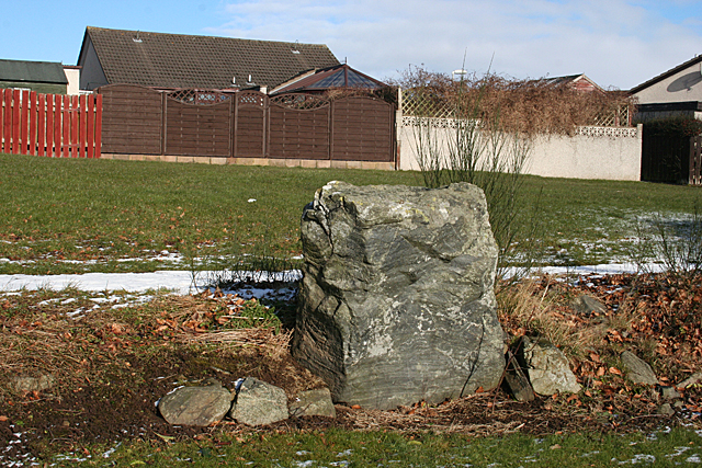
Image: © Anne Burgess Taken: 25 Feb 2016
This is one of the stones that made up the stone circle beside the Brandsbutt Stone. It and its fellow had been built into a field wall, but when the area was redeveloped as housing they were re-erected beide the Brandsbutt Stone. It is named on the 1:25,000 map as 'Douping Stone' but I have not found any explanation for this. https://canmore.org.uk/site/18882/brandsbutt for more information.
Images are licensed for reuse under creativecommons.org/licenses/by-sa/2.0
Image Location
Latitude
57.291575
Longitude
-2.399827