Complicated cloudscape
Introduction
The photograph on this page of Complicated cloudscape by Bob Harvey as part of the Geograph project.
The Geograph project started in 2005 with the aim of publishing, organising and preserving representative images for every square kilometre of Great Britain, Ireland and the Isle of Man.

There are currently over 7.5m images from over 14,400 individuals and you can help contribute to the project by visiting https://www.geograph.org.uk
Complicated cloudscape
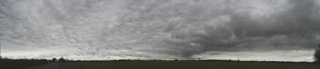
Image: © Bob Harvey Taken: 28 Feb 2016
This is an in-camera panorama of the cloudscape seen from Thistleton lane, observed from the northwest round to the southeast, centred roughly on the northeast direction. A bunch of individual photos taken at the same time were stitched into a higher resolution version, which can be seen at https://photosynth.net/view/9d18ca9b-e5e7-4670-8e53-bbcf3dcc5e1a
Images are licensed for reuse under creativecommons.org/licenses/by-sa/2.0
Image Location


Leaflet Map data © OpenStreetMap
Latitude
52.72497
Longitude
-0.619959