Defending Dorset in 1940: Wimborne Anti-tank Island (1)
Introduction
The photograph on this page of Defending Dorset in 1940: Wimborne Anti-tank Island (1) by Mike Searle as part of the Geograph project.
The Geograph project started in 2005 with the aim of publishing, organising and preserving representative images for every square kilometre of Great Britain, Ireland and the Isle of Man.

There are currently over 7.5m images from over 14,400 individuals and you can help contribute to the project by visiting https://www.geograph.org.uk
Defending Dorset in 1940: Wimborne Anti-tank Island (1)
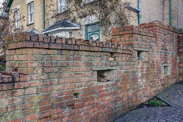
Image: © Mike Searle Taken: 24 Feb 2016
- Loopholed wall: DoB ID: e25267 Wimborne - West Borough - Loopholed Wall. The only surviving structure in Wimborne of the town's defences when it was designated an anti-tank island in 1940. This loopholed wall between two properties in West Borough was built to bring fire to bear on the approach road from the crossing of the River Allen to the north. The house directly opposite (the Old Saddlery) on the other side of the road was also requisitioned at the time, and handed over to the Home Guard to be used as a defended house. The second floor with its tiny north-facing window overlooking the street, may have served as a discreet observation post. Image
Images are licensed for reuse under creativecommons.org/licenses/by-sa/2.0
Image Location
Latitude
50.802887
Longitude
-1.989021