Listed buildings, Combe Down
Introduction
The photograph on this page of Listed buildings, Combe Down by Derek Harper as part of the Geograph project.
The Geograph project started in 2005 with the aim of publishing, organising and preserving representative images for every square kilometre of Great Britain, Ireland and the Isle of Man.

There are currently over 7.5m images from over 14,400 individuals and you can help contribute to the project by visiting https://www.geograph.org.uk
Listed buildings, Combe Down
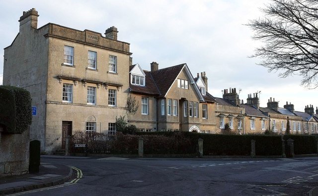
Image: © Derek Harper Taken: 23 Feb 2016
On the left is the bank shown in Image]; next door is the "eccentric design" of Lonsdale https://www.historicengland.org.uk/listing/the-list/list-entry/1395680 , followed by a terrace of 10, "dated 1729 in central pediment, but detail mainly looks later C18 and C19, with C20 alteration ... very early example of dedicated industrial housing ... local accommodation for the quarrymen, who did not have to travel and were consequently more efficient" https://www.historicengland.org.uk/listing/the-list/list-entry/1395682 .
Images are licensed for reuse under creativecommons.org/licenses/by-sa/2.0
Image Location
Latitude
51.359436
Longitude
-2.34665