Lions Den Railway Crossing, Bradkirk Lane
Introduction
The photograph on this page of Lions Den Railway Crossing, Bradkirk Lane by Adam C Snape as part of the Geograph project.
The Geograph project started in 2005 with the aim of publishing, organising and preserving representative images for every square kilometre of Great Britain, Ireland and the Isle of Man.

There are currently over 7.5m images from over 14,400 individuals and you can help contribute to the project by visiting https://www.geograph.org.uk
Lions Den Railway Crossing, Bradkirk Lane
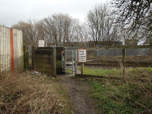
Image: © Adam C Snape Taken: 21 Feb 2016
Bradkirk Lane is so named because it used to lead across the railway to Bradkirk Hospital which dealt with contagious diseases. The route remains a public bridleway up to the crossing. It is, however, a dead end for horses because the railway crossing is now just a foot crossing allowing access to Walton Summit Industrial Estate. The crossing is known as Lions Den Crossing because there used to be a nearby farm called Lions Den. Comparison with an earlier photo of the crossing (taken from the other side) shows that metal gates have replaced wooden ones in recent years. See Image
Images are licensed for reuse under creativecommons.org/licenses/by-sa/2.0
Image Location
Latitude
53.725963
Longitude
-2.644847