Iddesleigh Methodist chapel
Introduction
The photograph on this page of Iddesleigh Methodist chapel by Derek Harper as part of the Geograph project.
The Geograph project started in 2005 with the aim of publishing, organising and preserving representative images for every square kilometre of Great Britain, Ireland and the Isle of Man.

There are currently over 7.5m images from over 14,400 individuals and you can help contribute to the project by visiting https://www.geograph.org.uk
Iddesleigh Methodist chapel
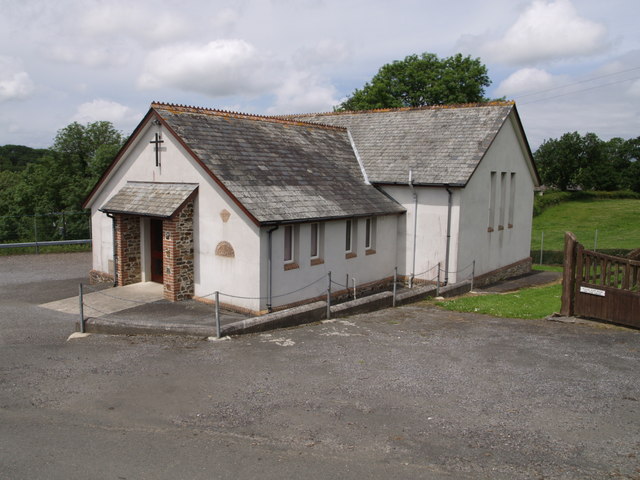
Image: © Derek Harper Taken: 28 Jun 2007
The plaque states that this is the Bible Christian Chapel; the date is 1890. Mugs were produced in 1990 to commemorate the centenary. The chapel is situated at the junction of the B3217 and the lane to Loosedon Cross past Whitemoor. On the right is the gate to the cemetery.
Images are licensed for reuse under creativecommons.org/licenses/by-sa/2.0
Image Location
Latitude
50.857982
Longitude
-4.034825