
Holt Castle
Introduction
The photograph on this page of Holt Castle by Jeff Buck as part of the Geograph project.
The Geograph project started in 2005 with the aim of publishing, organising and preserving representative images for every square kilometre of Great Britain, Ireland and the Isle of Man.

There are currently over 7.5m images from over 14,400 individuals and you can help contribute to the project by visiting https://www.geograph.org.uk
Holt Castle
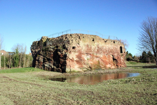
Image: © Jeff Buck Taken: 15 Feb 2016
The remains of Holt Castle seen from the south-west. Holt castle has undergone a four year restoration project (funded by Wrexham Heritage Service with financial assistance from the Rural Development Plan for Wales) and re-opened in June 2015. The restoration involved the removal of vegetation to conserve the remaining masonry and installing new and improved interpretation boards. A new staircase has also been installed to allow access to the castle's courtyard. *Source: Wrexham.com The same view of Holt Castle before restoration Image] Wikipedia https://en.wikipedia.org/wiki/Holt_Castle
Images are licensed for reuse under creativecommons.org/licenses/by-sa/2.0
Image Location

Latitude
53.077805
Longitude
-2.880377