The former Crown, Brandon Street
Introduction
The photograph on this page of The former Crown, Brandon Street by Stephen Richards as part of the Geograph project.
The Geograph project started in 2005 with the aim of publishing, organising and preserving representative images for every square kilometre of Great Britain, Ireland and the Isle of Man.

There are currently over 7.5m images from over 14,400 individuals and you can help contribute to the project by visiting https://www.geograph.org.uk
The former Crown, Brandon Street
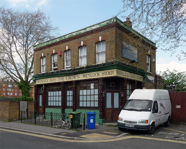
Image: © Stephen Richards Taken: 6 May 2013
Another dead pub, the tiled front and Wenlock Ales signage happily intact, at least for the time being. At the time of writing (2016) it still appears to be standing, but a few years ago locals were campaigning against developers who wanted to bulldoze it and build seven thousand flats in its place (I may have exaggerated that number).
Images are licensed for reuse under creativecommons.org/licenses/by-sa/2.0
Image Location
Latitude
51.490099
Longitude
-0.092191