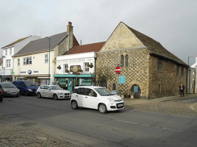
Shoreham-by-Sea: The Marlipins
Introduction
The photograph on this page of Shoreham-by-Sea: The Marlipins by Nigel Cox as part of the Geograph project.
The Geograph project started in 2005 with the aim of publishing, organising and preserving representative images for every square kilometre of Great Britain, Ireland and the Isle of Man.
There are currently over 7.5m images from over 14,400 individuals and you can help contribute to the project by visiting https://www.geograph.org.uk

Image: © Nigel Cox Taken: 5 Feb 2016
The Marlipins, now a local and maritime museum, is thought to have originally been the town's medieval Customs House, although several other uses have been suggested for it. It is both a Scheduled Ancient Monument and a Grade II* Listed Building. The Ancient Monument scheduling provides the following description:- "The medieval house is a two-storey building dating between the 12th and 14th century. The south front, facing the high street, is a chequerboard of squared dressed stone and flint with stone dressings and a rendered gable end above. It has pointed doorways on the ground floor and three pointed windows. The house has a Horsham stone slab roof, which is hipped to the north. On the east side, facing Middle Street, the wall is of flint and pebble with some red brick patching. There are three large casement windows on the first floor and two small depressed-arched windows on the ground-floor. The interior includes a collar-purlin roof supported by two queen-posts in the centre and on crown-posts at the ends. The original 14th century floor survives. In 2002, archaeological investigations on the site recorded a stone-lined pit, possibly part of a garderobe, and several other medieval and post-medieval pits. The original use of the building is thought to have been a Customs House for wine or beer duty. It has also been suggested that it may be part of the remains of a Carmelite friary, which was founded in 1316 to the south of the High Street. In 1348, a grant of one and a half acres was given by Sir John de Mowbray to allow the friary to extend north of the High Street, further from the sea." The Listed Building description is similar, but provides further architectural information that the stone is from Caen and goes into greater detail that there are "Painted pointed-arched windows with round-headed relieving arch over on first floor, to right of centre. Pointed arched and chamfered stone surround doorways to right and left on ground floor with small pointed-arched window off-centre to left. Boarded and ribbed doors, probably C19." Please compare with Bob's Image from July 1986. On the left is the eponymous public house.
Image Location


