Parish conduit
Introduction
The photograph on this page of Parish conduit by Alan Murray-Rust as part of the Geograph project.
The Geograph project started in 2005 with the aim of publishing, organising and preserving representative images for every square kilometre of Great Britain, Ireland and the Isle of Man.

There are currently over 7.5m images from over 14,400 individuals and you can help contribute to the project by visiting https://www.geograph.org.uk
Parish conduit
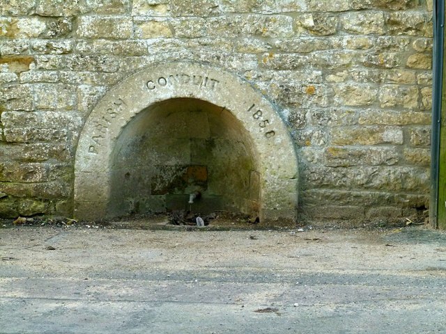
Image: © Alan Murray-Rust Taken: 3 Feb 2016
Created in 1858 as a common supply of water for the village. It was fed from the White Well spring that gave its name to the village. Listed Grade II with the barn it is built into.
Images are licensed for reuse under creativecommons.org/licenses/by-sa/2.0
Image Location
Latitude
52.669037
Longitude
-0.634292