Recreation Road Vicinity, Mansfield, Notts.
Introduction
The photograph on this page of Recreation Road Vicinity, Mansfield, Notts. by David Hallam-Jones as part of the Geograph project.
The Geograph project started in 2005 with the aim of publishing, organising and preserving representative images for every square kilometre of Great Britain, Ireland and the Isle of Man.

There are currently over 7.5m images from over 14,400 individuals and you can help contribute to the project by visiting https://www.geograph.org.uk
Recreation Road Vicinity, Mansfield, Notts.
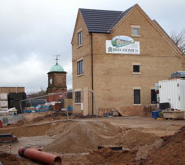
Image: © David Hallam-Jones Taken: 7 Feb 2016
BMA Ltd of Tuxford, Newark are in the process of building 14 residential properties on a plot of land sandwiched between the rear gardens (or backyards) of the existing terraced houses on Recreation Road and the tower in the distance. St Peter's Way (i.e. the A60/A6006) passes between the tower - situated in a former quarry known as Rock Valley - and one side of a natural rock embankment 75 metres behind this new house. The entrance to this small new-build development will be behind where the photographer was standing. The domed clocktower is the only structure remaining on the former Metal Box Company factory site in the former quarry in question.
Images are licensed for reuse under creativecommons.org/licenses/by-sa/2.0
Image Location
Latitude
53.145369
Longitude
-1.190075