Pelham Street, Mansfield, Notts.
Introduction
The photograph on this page of Pelham Street, Mansfield, Notts. by David Hallam-Jones as part of the Geograph project.
The Geograph project started in 2005 with the aim of publishing, organising and preserving representative images for every square kilometre of Great Britain, Ireland and the Isle of Man.

There are currently over 7.5m images from over 14,400 individuals and you can help contribute to the project by visiting https://www.geograph.org.uk
Pelham Street, Mansfield, Notts.
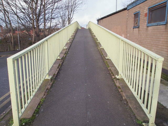
Image: © David Hallam-Jones Taken: 7 Feb 2016
The fact that Pelham Street is now a cul-de-sac is evident from the left-hand side of the picture. In the past - before the St Peter's Way (i.e. the A60/A6006) was constructed - perhaps it continued ahead? This footbridge carries users over this dual carriageway to Rock Valley, the area where the Metal Box Company's huge site could once be found.
Images are licensed for reuse under creativecommons.org/licenses/by-sa/2.0
Image Location
Latitude
53.144293
Longitude
-1.190544