Ashwell village well
Introduction
The photograph on this page of Ashwell village well by Alan Murray-Rust as part of the Geograph project.
The Geograph project started in 2005 with the aim of publishing, organising and preserving representative images for every square kilometre of Great Britain, Ireland and the Isle of Man.

There are currently over 7.5m images from over 14,400 individuals and you can help contribute to the project by visiting https://www.geograph.org.uk
Ashwell village well
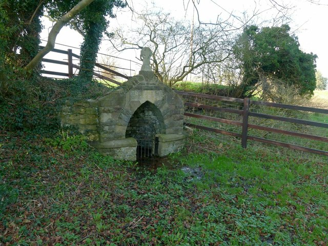
Image: © Alan Murray-Rust Taken: 28 Jan 2016
A 19th century Gothic style structure surrounds the actual well. There is a typically Victorian moral verse above the niche http://www.geograph.org.uk/photo/4811089. The 'sacred sign' clearly relates to the cross on the top, which is a recent replacement. There is still plenty of water around; I wasn't wearing wellies so couldn't get too close! The well is Listed Grade II.
Images are licensed for reuse under creativecommons.org/licenses/by-sa/2.0
Image Location


Leaflet Map data © OpenStreetMap
Latitude
52.713438
Longitude
-0.722024