Abbey Bridge, Lenton, Nottingham
Introduction
The photograph on this page of Abbey Bridge, Lenton, Nottingham by David Hallam-Jones as part of the Geograph project.
The Geograph project started in 2005 with the aim of publishing, organising and preserving representative images for every square kilometre of Great Britain, Ireland and the Isle of Man.

There are currently over 7.5m images from over 14,400 individuals and you can help contribute to the project by visiting https://www.geograph.org.uk
Abbey Bridge, Lenton, Nottingham
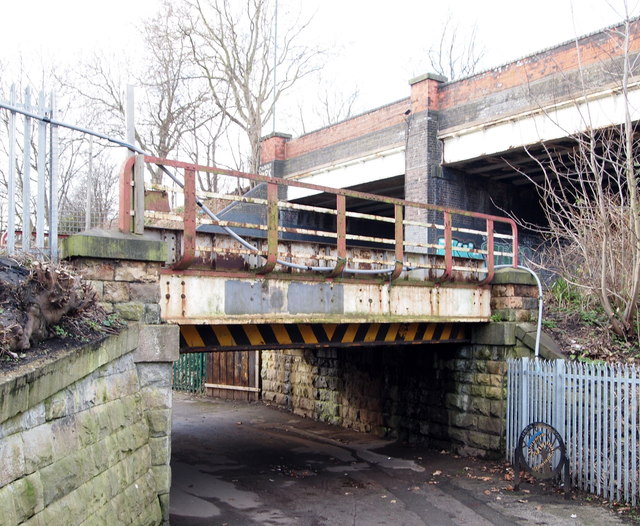
Image: © David Hallam-Jones Taken: 30 Jan 2016
Some users joining this 600-700 metre shortcut for pedestrians and cyclists between the closed end of the Grove Road cul-de-sac and Lenton Lane are obliged to duck down in order to pass beneath the lower of these two bridges, i.e. a railway bridge. Above it, the A6005 is carried over it by Abbey Bridge. Road traffic travelling in a southwesterly direction on the latter, i.e. to the left, will arrive at the east side of the Queen's Medical Centre (< a hospital) within minutes.
Images are licensed for reuse under creativecommons.org/licenses/by-sa/2.0
Image Location
Latitude
52.945778
Longitude
-1.173121