Nazareth Road, Dunkirk, Nottingham
Introduction
The photograph on this page of Nazareth Road, Dunkirk, Nottingham by David Hallam-Jones as part of the Geograph project.
The Geograph project started in 2005 with the aim of publishing, organising and preserving representative images for every square kilometre of Great Britain, Ireland and the Isle of Man.

There are currently over 7.5m images from over 14,400 individuals and you can help contribute to the project by visiting https://www.geograph.org.uk
Nazareth Road, Dunkirk, Nottingham
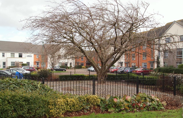
Image: © David Hallam-Jones Taken: 30 Jan 2016
This cherry tree and a stone tablet on the ground beneath it exist as a memorial to the work of the Congregation of the Poor Sisters of Nazareth who looked after children (in a children’s home) and the elderly in a combined religious and care ‘complex’ here between 1880-2002. In the early 2000s the Congregation’s financial difficulties made selling the site a necessity. The sale was completed in 2005 and all the buildings, with the exception of “Priory House” - an early C19th castellated house behind the photographer - were demolished and the area turned into an up-market housing estate. The house has been converted into an apartment block. There is a branch of Nazareth Road behind the photographer’s left shoulder (a cul-de-sac) that peters out within a matter of seconds. Pedestrians and cyclists can however, continue into Old Church Street using a footpath. This reaches the Priory Church of St Anthony within a minute or two.
Images are licensed for reuse under creativecommons.org/licenses/by-sa/2.0
Image Location
Latitude
52.942401
Longitude
-1.178691