Straight to the water?
Introduction
The photograph on this page of Straight to the water? by Neil Owen as part of the Geograph project.
The Geograph project started in 2005 with the aim of publishing, organising and preserving representative images for every square kilometre of Great Britain, Ireland and the Isle of Man.

There are currently over 7.5m images from over 14,400 individuals and you can help contribute to the project by visiting https://www.geograph.org.uk
Straight to the water?
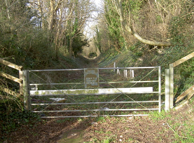
Image: © Neil Owen Taken: 28 Jan 2016
This land is now operated by Bristol Water, but was in fact an old dramway - hence the straight track. The coalpits to the northeast of Bristol expanded in the early nineteenth century and efforts were made to transport the sacks to wharves on the Avon near Keynsham. After an act and the raising of the capital, the last stretch opened here in 1832. The horse-drawn loads were run until 1867, when new train mainlines were built that severed it in several places and caused its closure. After a local businessman tried to regenerate it by buying a colliery, it was revived in 1881; however, a disastrous flood in 1904 ended the mining. In 1935, the land was sold to Bristol Water Works, who used it for new pipelaying. Just up the way here is a short tunnel, which was used as an air-raid shelter in the war. It is now a home for rare bat species.
Images are licensed for reuse under creativecommons.org/licenses/by-sa/2.0
Image Location


Leaflet Map data © OpenStreetMap
Latitude
51.43161
Longitude
-2.481982