Blue Plaque: Church of St Lawrence
Introduction
The photograph on this page of Blue Plaque: Church of St Lawrence by Gerald England as part of the Geograph project.
The Geograph project started in 2005 with the aim of publishing, organising and preserving representative images for every square kilometre of Great Britain, Ireland and the Isle of Man.

There are currently over 7.5m images from over 14,400 individuals and you can help contribute to the project by visiting https://www.geograph.org.uk
Blue Plaque: Church of St Lawrence
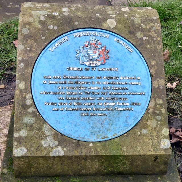
Image: © Gerald England Taken: 18 Jan 2016
One of two blue plaques Image at St Lawrence's. This one reads: TAMESIDE METROPOLITAN BOROUGH CHURCH OF ST LAWRENCE Built early Sixteenth Century and originally dedicated to St James until the discovery in the mid-nineteenth century of a stained glass window to St Lawrence. Affectionately known as 'Th'Owd Peg' because its framework was fastened together with wooden pegs. Resting place of John Angier, the famous Puritan divine and of Colonel Robert Duckenfield, Tameside's Civil War hero.
Images are licensed for reuse under creativecommons.org/licenses/by-sa/2.0
Image Location
Latitude
53.452156
Longitude
-2.112145