Rectory Lane
Introduction
The photograph on this page of Rectory Lane by Mick Garratt as part of the Geograph project.
The Geograph project started in 2005 with the aim of publishing, organising and preserving representative images for every square kilometre of Great Britain, Ireland and the Isle of Man.

There are currently over 7.5m images from over 14,400 individuals and you can help contribute to the project by visiting https://www.geograph.org.uk
Rectory Lane
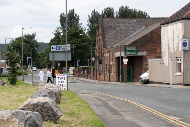
Image: © Mick Garratt Taken: 28 Jun 2007
The building opposite was built in 1879 and was the Providence School. Now it is the Territorial Social club. When it was used as a school this road was known as Providence Street but has since become an extension of Rectory Lane.
Images are licensed for reuse under creativecommons.org/licenses/by-sa/2.0
Image Location
Latitude
54.532966
Longitude
-1.054369