The River Meese
Introduction
The photograph on this page of The River Meese by Richard Law as part of the Geograph project.
The Geograph project started in 2005 with the aim of publishing, organising and preserving representative images for every square kilometre of Great Britain, Ireland and the Isle of Man.

There are currently over 7.5m images from over 14,400 individuals and you can help contribute to the project by visiting https://www.geograph.org.uk
The River Meese
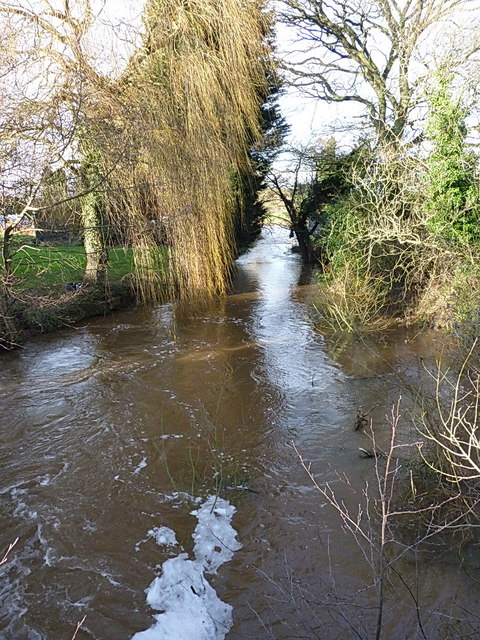
Image: © Richard Law Taken: 10 Jan 2016
Looking downstream from the Mill Lane bridge at the Meese, which is running at winter levels after several wet weeks. The Meese rises in the farmland between Cheswardine and Norbury, is known for part of its course as the Lonco Brook, and flows down to join the Tern near Cold Hatton in Image
Images are licensed for reuse under creativecommons.org/licenses/by-sa/2.0
Image Location
Latitude
52.780948
Longitude
-2.475115