Sandhurst Avenue, Mansfield, Notts.
Introduction
The photograph on this page of Sandhurst Avenue, Mansfield, Notts. by David Hallam-Jones as part of the Geograph project.
The Geograph project started in 2005 with the aim of publishing, organising and preserving representative images for every square kilometre of Great Britain, Ireland and the Isle of Man.

There are currently over 7.5m images from over 14,400 individuals and you can help contribute to the project by visiting https://www.geograph.org.uk
Sandhurst Avenue, Mansfield, Notts.
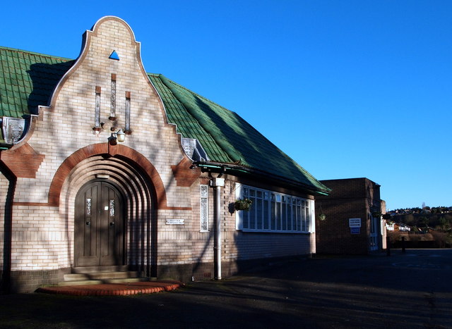
Image: © David Hallam-Jones Taken: 15 Jan 2016
Detail of the 'Dutch Cape' style entrance into the Mansfield Sand Company's combined gatekeeper's lodge and office. The date of construction and who the architect was are unknown at present. The houses in the distance, i.e. on the other side of the quarry seem likely to be situated on Berry Hill Road.
Images are licensed for reuse under creativecommons.org/licenses/by-sa/2.0
Image Location
Latitude
53.130192
Longitude
-1.192304