Telephone Exchange, Cumnor Hill
Introduction
The photograph on this page of Telephone Exchange, Cumnor Hill by David Hillas as part of the Geograph project.
The Geograph project started in 2005 with the aim of publishing, organising and preserving representative images for every square kilometre of Great Britain, Ireland and the Isle of Man.

There are currently over 7.5m images from over 14,400 individuals and you can help contribute to the project by visiting https://www.geograph.org.uk
Telephone Exchange, Cumnor Hill
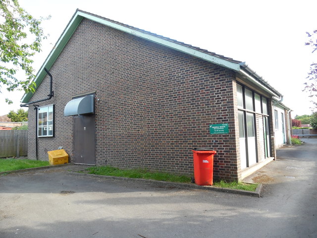
Image: © David Hillas Taken: 9 Jun 2015
Situated in Orchard Road, this TE dates from the GPO era and used to take the name Cumnor which is an adjacent village. It has the code SMCNR and provides telephone and broadband services to 2,768 residential and 107 non-residential premises in Cumnor and Cumnor Hill, plus Appleton, Eaton, Farmoor and Henwood nearby. A yellow grit salt bin and a red container can be seen in front of this building. The green notice refers to General Waste (not hazardous) for BT use only. This TE has the numbering range (01865) 86xxxx, the (01865) referring to the Oxford group of twenty TEs, and its postcode is OX2 9JG.
Images are licensed for reuse under creativecommons.org/licenses/by-sa/2.0
Image Location
Latitude
51.740416
Longitude
-1.309569