The SE fish trap in Fishguard Bay (1)
Introduction
The photograph on this page of The SE fish trap in Fishguard Bay (1) by Natasha Ceridwen de Chroustchoff as part of the Geograph project.
The Geograph project started in 2005 with the aim of publishing, organising and preserving representative images for every square kilometre of Great Britain, Ireland and the Isle of Man.

There are currently over 7.5m images from over 14,400 individuals and you can help contribute to the project by visiting https://www.geograph.org.uk
The SE fish trap in Fishguard Bay (1)
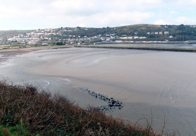
Image: © Natasha Ceridwen de Chroustchoff Taken: 12 Jan 2013
From Coflein (Royal Commission on ancient and historical monuments of Wales) "A'V'-shaped stone-built fish trap, springing from coastal rocks on [the bay's] south side. It measures approximately 34m from base to apex, with equally-spaced arms measuring 40m long and up to 9m broad. It is built from large boulders, now partly dispersed with a few smaller stones visible in the matrix. The trap is only exposed at the lowest tides, of 0.5m and under. It is likely that a build-up of sand behind (to the west, beach-side of) the trap may have obscured further parts making it considerably larger. Because of the present sea-level it would be difficult to regularly use and make repairs to this fish trap, and this might indicate a construction date back in the Middle Ages, or earlier. This trap is not mapped on any sea-charts or historic maps, unlike its counterpart on the north-west side of Fishguard Harbour. The site was discovered and photographed through shallow water during Royal Commission aerial reconnaissance." This view of the fish trap is taken at low tide from the Marine Walk above, looking across the beach to the small town of Goodwick.
Images are licensed for reuse under creativecommons.org/licenses/by-sa/2.0
Image Location


Leaflet Map data © OpenStreetMap
Latitude
52.000564
Longitude
-4.982288