Clyde Tunnel
Introduction
The photograph on this page of Clyde Tunnel by Richard Webb as part of the Geograph project.
The Geograph project started in 2005 with the aim of publishing, organising and preserving representative images for every square kilometre of Great Britain, Ireland and the Isle of Man.

There are currently over 7.5m images from over 14,400 individuals and you can help contribute to the project by visiting https://www.geograph.org.uk
Clyde Tunnel
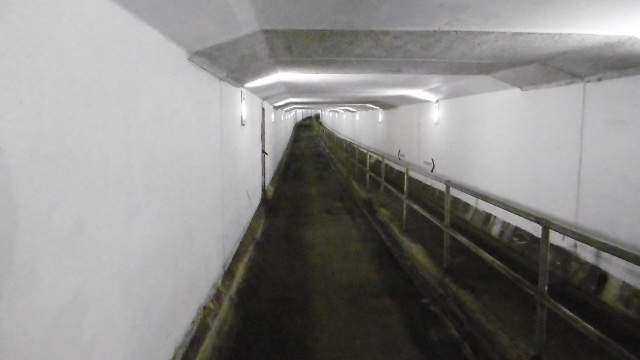
Image: © Richard Webb Taken: 4 Jan 2016
The bike and pedestrian path in the northbound tunnel, near the southern portal. The tunnel is a circular bore and the paths use the space under the road deck.
Images are licensed for reuse under creativecommons.org/licenses/by-sa/2.0
Image Location
Latitude
55.86324
Longitude
-4.332385