Sutton-in-Ashfield - Stratford House on Outram Street
Introduction
The photograph on this page of Sutton-in-Ashfield - Stratford House on Outram Street by Dave Bevis as part of the Geograph project.
The Geograph project started in 2005 with the aim of publishing, organising and preserving representative images for every square kilometre of Great Britain, Ireland and the Isle of Man.

There are currently over 7.5m images from over 14,400 individuals and you can help contribute to the project by visiting https://www.geograph.org.uk
Sutton-in-Ashfield - Stratford House on Outram Street
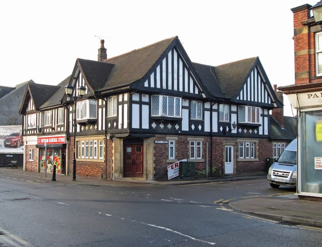
Image: © Dave Bevis Taken: 27 Dec 2015
This half-timbered house on Outram Street at its junction with North Street, looks very like a former public house. However, I have been unable to find any reference to the use of the building as a pub. The Picture-The-Past website identifies the building as "Stratford House" and being used as flats around 1975 - see http://www.picturethepast.org.uk/frontend.php?keywords=Ref_No_increment;EQUALS;NCCA000205&pos=55&action=zoom&id=108712 . The building is again being used as flats in 2016.
Images are licensed for reuse under creativecommons.org/licenses/by-sa/2.0
Image Location
Latitude
53.128098
Longitude
-1.257204