West Street, Rottingdean
Introduction
The photograph on this page of West Street, Rottingdean by Simon Carey as part of the Geograph project.
The Geograph project started in 2005 with the aim of publishing, organising and preserving representative images for every square kilometre of Great Britain, Ireland and the Isle of Man.

There are currently over 7.5m images from over 14,400 individuals and you can help contribute to the project by visiting https://www.geograph.org.uk
West Street, Rottingdean
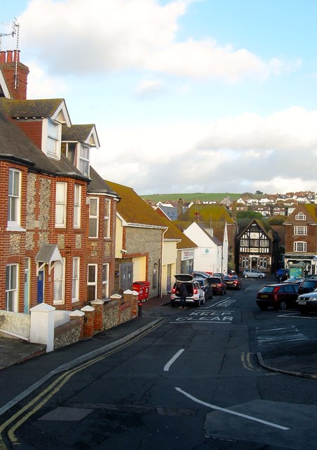
Image: © Simon Carey Taken: 31 Dec 2015
Linking Marine Drive to High Street, the road was in existence by the 1839 tithe map though only a couple of cottages existed at the eastern end of the street. The terrace on the left, Victoria Cottages, was added at the turn of the 20th century. Beyond is Tesco which opened in the last decade or so on the site of a former car dealership which had been built after the Second World War on the site of former farm buildings. At the foot of the street is number 1, the only remaining cottage of a terrace of four which survived until the 1960s but were pulled down to make way for the extension of the car dealership. The southern side was removed in its entirety in the 1930s as part of the widening of Marine Drive with the area in between now a car park.
Images are licensed for reuse under creativecommons.org/licenses/by-sa/2.0
Image Location
Latitude
50.803451
Longitude
-0.057849