Mansfield Woodhouse Bandstand
Introduction
The photograph on this page of Mansfield Woodhouse Bandstand by James Hill as part of the Geograph project.
The Geograph project started in 2005 with the aim of publishing, organising and preserving representative images for every square kilometre of Great Britain, Ireland and the Isle of Man.

There are currently over 7.5m images from over 14,400 individuals and you can help contribute to the project by visiting https://www.geograph.org.uk
Mansfield Woodhouse Bandstand
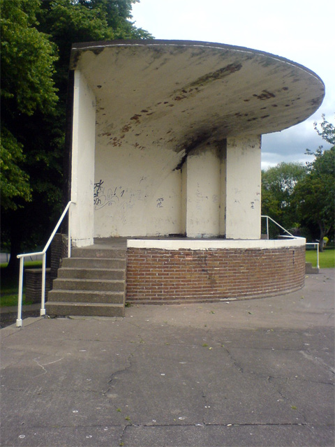
Image: © James Hill Taken: 26 Jun 2007
Looking rather unloved, this bandstand is in the park across from St. Edmund's church. It is just on the border of SK5363 and SK5463, so much so that a shot taken from the front of the bandstand would put it in a different square to one from the side as here. At least it would appear to be so when using OS Explorer and Google Earth to obtain a grid reference.
Images are licensed for reuse under creativecommons.org/licenses/by-sa/2.0
Image Location
Latitude
53.161602
Longitude
-1.193943