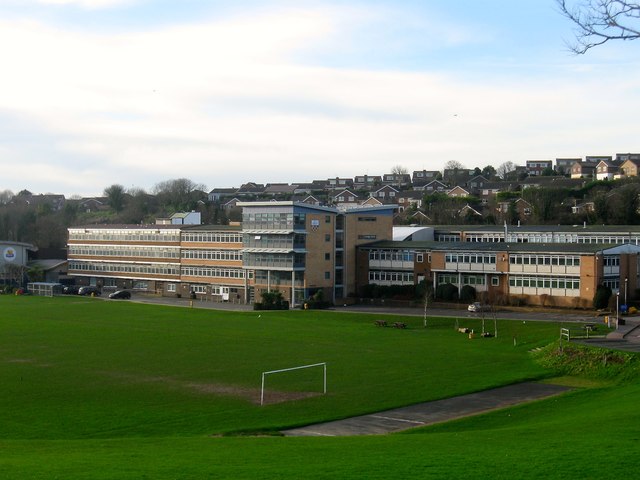
Longhill School, Falmer Road, Rottingdean
Introduction
The photograph on this page of Longhill School, Falmer Road, Rottingdean by Simon Carey as part of the Geograph project.
The Geograph project started in 2005 with the aim of publishing, organising and preserving representative images for every square kilometre of Great Britain, Ireland and the Isle of Man.
There are currently over 7.5m images from over 14,400 individuals and you can help contribute to the project by visiting https://www.geograph.org.uk

Image: © Simon Carey Taken: 28 Dec 2015
Built in 1963 on a former field called Creek Bottom according to Ovingdean's 1839 tithe map. The school's catchment area includes Rottingdean, Saltdean, Ovingdean, Woodingdean and since the closure of Stanley Deason in 2005 those of the Whitehawk and Manor Hill estates which give it an interesting mix to say the least. Despite being located in the old parish of Ovingdean its current address is Rottingdean though the houses behind are officially in the former.

