Flooded footpath to Billinge Plantation
Introduction
The photograph on this page of Flooded footpath to Billinge Plantation by Gary Rogers as part of the Geograph project.
The Geograph project started in 2005 with the aim of publishing, organising and preserving representative images for every square kilometre of Great Britain, Ireland and the Isle of Man.

There are currently over 7.5m images from over 14,400 individuals and you can help contribute to the project by visiting https://www.geograph.org.uk
Flooded footpath to Billinge Plantation
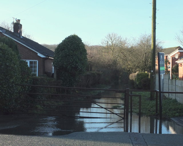
Image: © Gary Rogers Taken: 27 Dec 2015
From Upholland Road. Fields to the south of this path and east of the plantation drain into a narrow channel that runs alongside this path. There is a duckpond about 100m from the road but occasionally after prolonged or heavy rain the channel cannot cope with the volume of water and the path floods. Drains on Upholland Road were doing a reasonable job of dealing with the flood water and preventing in flowing across the road and down Longshaw Old Road.
Images are licensed for reuse under creativecommons.org/licenses/by-sa/2.0
Image Location
Latitude
53.514547
Longitude
-2.709796