Turnford Brook & Mylne Aqueduct, New River
Introduction
The photograph on this page of Turnford Brook & Mylne Aqueduct, New River by David Kemp as part of the Geograph project.
The Geograph project started in 2005 with the aim of publishing, organising and preserving representative images for every square kilometre of Great Britain, Ireland and the Isle of Man.

There are currently over 7.5m images from over 14,400 individuals and you can help contribute to the project by visiting https://www.geograph.org.uk
Turnford Brook & Mylne Aqueduct, New River
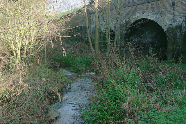
Image: © David Kemp Taken: 23 Dec 2015
This shows the western arches of the aqueduct which was built in the 1850s to carry the New River over Turnford Brook (seen in the foreground) thereby avoiding a considerable detour to the west.
Images are licensed for reuse under creativecommons.org/licenses/by-sa/2.0
Image Location


Leaflet Map data © OpenStreetMap
Latitude
51.724952
Longitude
-0.030483