Wellow, Notts.
Introduction
The photograph on this page of Wellow, Notts. by David Hallam-Jones as part of the Geograph project.
The Geograph project started in 2005 with the aim of publishing, organising and preserving representative images for every square kilometre of Great Britain, Ireland and the Isle of Man.

There are currently over 7.5m images from over 14,400 individuals and you can help contribute to the project by visiting https://www.geograph.org.uk
Wellow, Notts.
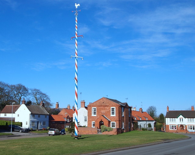
Image: © David Hallam-Jones Taken: 22 Feb 2015
The Maypole, with its crown and cockerel aloft, sits centrally between Eakring Road in the foreground and Maypole Green its rear. The pole was last replaced in 2011. The original shape of this green space was (is) unique for a Nottinghamshire village green. Over the centuries footpaths and buildings have contributed to the alteration of its original shape, as has its bisection by Eaking Road. The green's shape is that of an isosceles triangle (i.e. the shape of a C12/C13th arrow head) and it is said that its orientation, pointing 17.5 degrees west of south, was constructed to cock-a-snook at the Sheriff of Nottingham, by pointing its tip towards his stronghold.
Images are licensed for reuse under creativecommons.org/licenses/by-sa/2.0
Image Location
Latitude
53.188235
Longitude
-0.999199