The Crescent, Compton Pauncefoot
Introduction
The photograph on this page of The Crescent, Compton Pauncefoot by Maigheach-gheal as part of the Geograph project.
The Geograph project started in 2005 with the aim of publishing, organising and preserving representative images for every square kilometre of Great Britain, Ireland and the Isle of Man.

There are currently over 7.5m images from over 14,400 individuals and you can help contribute to the project by visiting https://www.geograph.org.uk
The Crescent, Compton Pauncefoot
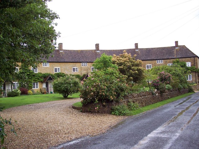
Image: © Maigheach-gheal Taken: 23 Jun 2007
The Crescent is a quarter circle of cottages built in about 1815 for farm workers, and originally known as Waterloo Crescent.
Images are licensed for reuse under creativecommons.org/licenses/by-sa/2.0
Image Location
Latitude
51.031177
Longitude
-2.508189