Croxley Rail Link (11): Former Watford Stadium Halt
Introduction
The photograph on this page of Croxley Rail Link (11): Former Watford Stadium Halt by Nigel Cox as part of the Geograph project.
The Geograph project started in 2005 with the aim of publishing, organising and preserving representative images for every square kilometre of Great Britain, Ireland and the Isle of Man.

There are currently over 7.5m images from over 14,400 individuals and you can help contribute to the project by visiting https://www.geograph.org.uk
Croxley Rail Link (11): Former Watford Stadium Halt
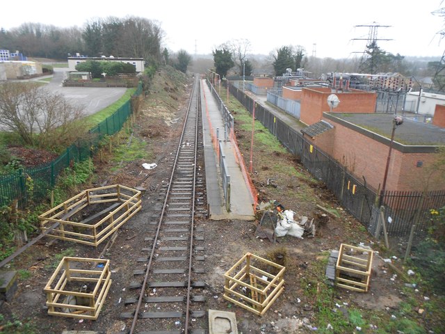
Image: © Nigel Cox Taken: 13 Dec 2015
The trackside vegetation has been cleared in preparation for the development of the link, revealing the former Watford Stadium Halt platform from the Vicarage Road bridge for the first time in many years. Compare with Image from June 2012 and Image from August 2013, and Image from the far end of the platform looking back in this direction from January 2006. The scheme is now known as the Metropolitan Line Extension.
Images are licensed for reuse under creativecommons.org/licenses/by-sa/2.0
Image Location
Latitude
51.646413
Longitude
-0.407528