Floodwater in Caldewgate
Introduction
The photograph on this page of Floodwater in Caldewgate by Rose and Trev Clough as part of the Geograph project.
The Geograph project started in 2005 with the aim of publishing, organising and preserving representative images for every square kilometre of Great Britain, Ireland and the Isle of Man.

There are currently over 7.5m images from over 14,400 individuals and you can help contribute to the project by visiting https://www.geograph.org.uk
Floodwater in Caldewgate
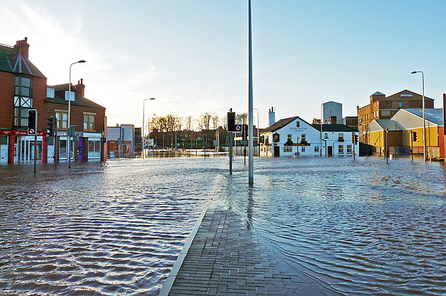
Image: © Rose and Trev Clough Taken: 6 Dec 2015
John Street (left) merges into Church Street just past the traffic lights. McVitie's biscuit factory is on the far right, with the Joiners Arms (white building) in front of it. The water level had already dropped by this time, as seen by a tide mark of debris further back on the road.
Images are licensed for reuse under creativecommons.org/licenses/by-sa/2.0
Image Location
Latitude
54.894589
Longitude
-2.946848