An aptly named road
Introduction
The photograph on this page of An aptly named road by Gordon Hatton as part of the Geograph project.
The Geograph project started in 2005 with the aim of publishing, organising and preserving representative images for every square kilometre of Great Britain, Ireland and the Isle of Man.

There are currently over 7.5m images from over 14,400 individuals and you can help contribute to the project by visiting https://www.geograph.org.uk
An aptly named road
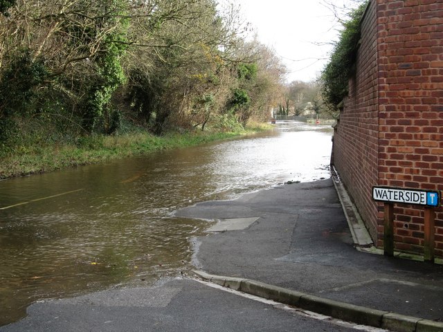
Image: © Gordon Hatton Taken: 6 Dec 2015
Waterside is quite some way from the River Ure on the Langthorpe side, but on the 6th December 2015 the river burst its banks and edged along the B6265 after heavy and continuous rains in the dales.
Images are licensed for reuse under creativecommons.org/licenses/by-sa/2.0
Image Location
Latitude
54.099555
Longitude
-1.399609