London Colney: Napsbury Park
Introduction
The photograph on this page of London Colney: Napsbury Park by Nigel Cox as part of the Geograph project.
The Geograph project started in 2005 with the aim of publishing, organising and preserving representative images for every square kilometre of Great Britain, Ireland and the Isle of Man.

There are currently over 7.5m images from over 14,400 individuals and you can help contribute to the project by visiting https://www.geograph.org.uk
London Colney: Napsbury Park
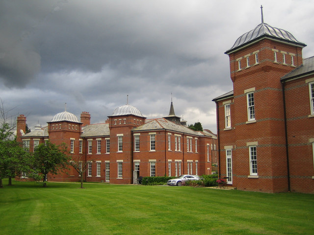
Image: © Nigel Cox Taken: 22 Jun 2007
In the distance on the left is one of the wards of the former Napsbury Hospital which was called the Middlesex County Lunatic Asylum when it was first built. It has been converted into residences by Crest Nicholson. I think that, looking at the Google Earth images of the site which currently show it before its conversion, the block on the right is new, but built in the style of the existing buildings.
Images are licensed for reuse under creativecommons.org/licenses/by-sa/2.0
Image Location
Latitude
51.72169
Longitude
-0.311936