Cottages on Titsey Hill
Introduction
The photograph on this page of Cottages on Titsey Hill by Derek Harper as part of the Geograph project.
The Geograph project started in 2005 with the aim of publishing, organising and preserving representative images for every square kilometre of Great Britain, Ireland and the Isle of Man.

There are currently over 7.5m images from over 14,400 individuals and you can help contribute to the project by visiting https://www.geograph.org.uk
Cottages on Titsey Hill
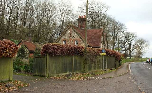
Image: © Derek Harper Taken: 15 Nov 2015
A pair of listed flint cottages, also seen in Image They date from about 1870 http://www.historicengland.org.uk/listing/the-list/list-entry/1189950 . A wash house block at the rear is also listed. In the foreground is the top of Pitchfont Lane, used by the North Down Way, and on the right is the B269.
Images are licensed for reuse under creativecommons.org/licenses/by-sa/2.0
Image Location
Latitude
51.281312
Longitude
0.00325