Nineteenth-century benchmark on Worcester County Court
Introduction
The photograph on this page of Nineteenth-century benchmark on Worcester County Court by Shantavira as part of the Geograph project.
The Geograph project started in 2005 with the aim of publishing, organising and preserving representative images for every square kilometre of Great Britain, Ireland and the Isle of Man.

There are currently over 7.5m images from over 14,400 individuals and you can help contribute to the project by visiting https://www.geograph.org.uk
Nineteenth-century benchmark on Worcester County Court
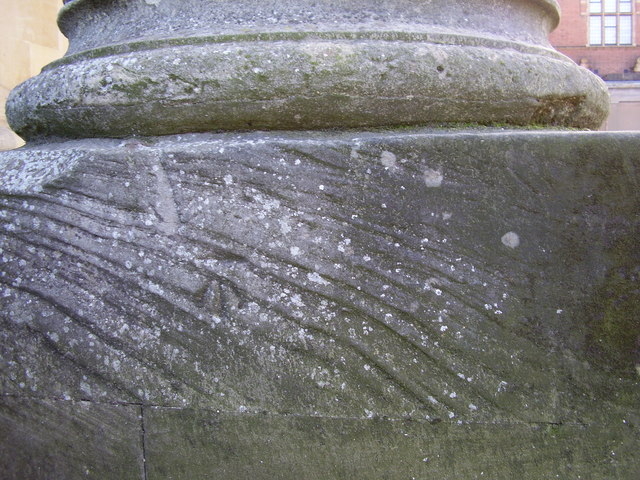
Image: © Shantavira Taken: 20 Nov 2015
This benchmark was established in 1844 during the First primary levelling of England & Wales, and was levelled with a height of 79.661 feet [24.281 metres] above mean sea level (Liverpool datum). It was included on the Manchester to Gloucester levelling line. The surveyor's description was "No. 383. Mark on face of stone work under pillar of portico of County Court House ; 2.11 ft. above centre of road" (Public Abstract p.34). The mark is faint and not easy to see on the weathered stonework, on the north face of the building, directly beneath the centre of the column.
Images are licensed for reuse under creativecommons.org/licenses/by-sa/2.0
Image Location
Latitude
52.196714
Longitude
-2.222482