Nineteenth-century benchmark on gate pier
Introduction
The photograph on this page of Nineteenth-century benchmark on gate pier by Shantavira as part of the Geograph project.
The Geograph project started in 2005 with the aim of publishing, organising and preserving representative images for every square kilometre of Great Britain, Ireland and the Isle of Man.

There are currently over 7.5m images from over 14,400 individuals and you can help contribute to the project by visiting https://www.geograph.org.uk
Nineteenth-century benchmark on gate pier
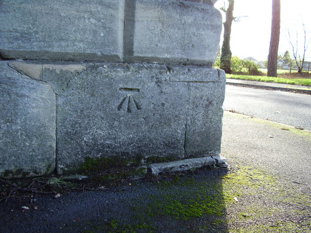
Image: © Shantavira Taken: 20 Nov 2015
This benchmark was established in 1844 during the First primary levelling of England & Wales, and was levelled with a height of 95.455 feet [29.095 metres] above mean sea level (Liverpool datum). It was included on the Manchester to Gloucester levelling line. The surveyor's description was "No.380 Mark on foundation stone of gate pier to Sir Offley Wakeman's demesne, Perdswell [sic]; 1.77 ft. above centre of road" (Public Abstract p.34). The mark is clearly visible on the north-west face of the north-east gatepost at the entrance to Perdiswell Park.
Images are licensed for reuse under creativecommons.org/licenses/by-sa/2.0
Image Location
Latitude
52.214968
Longitude
-2.220671