Simpson Square, Shrewsbury
Introduction
The photograph on this page of Simpson Square, Shrewsbury by Jaggery as part of the Geograph project.
The Geograph project started in 2005 with the aim of publishing, organising and preserving representative images for every square kilometre of Great Britain, Ireland and the Isle of Man.

There are currently over 7.5m images from over 14,400 individuals and you can help contribute to the project by visiting https://www.geograph.org.uk
Simpson Square, Shrewsbury
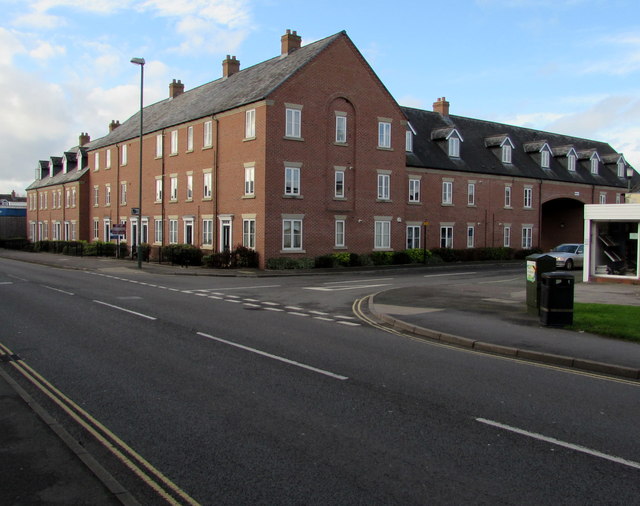
Image: © Jaggery Taken: 16 Nov 2015
Viewed across the northern end of the A5191 Castle Foregate which becomes the A5191 St Michael's Street nearby. Simpson Square is one of the newest residential blocks of flats in Shrewsbury. It occupies the site of Simpson’s Square, built c1810, demolished after the Second World War. John Simpson (1755-1815) was in charge of the rebuilding of St Chad's church http://www.geograph.org.uk/photo/4010162 in Shrewsbury in the 1790s.
Images are licensed for reuse under creativecommons.org/licenses/by-sa/2.0
Image Location
Latitude
52.715172
Longitude
-2.74841