Northern Parkland, Cherkley Court
Introduction
The photograph on this page of Northern Parkland, Cherkley Court by Ian Capper as part of the Geograph project.
The Geograph project started in 2005 with the aim of publishing, organising and preserving representative images for every square kilometre of Great Britain, Ireland and the Isle of Man.

There are currently over 7.5m images from over 14,400 individuals and you can help contribute to the project by visiting https://www.geograph.org.uk
Northern Parkland, Cherkley Court
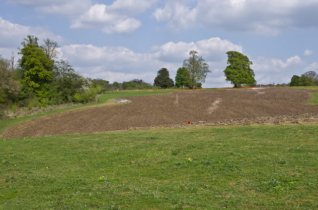
Image: © Ian Capper Taken: 6 May 2013
Each spring, the Northern Parkland at Cherkley Court is covered with Cowslips. However, in 2013 the whole area has been desecrated by work starting on an exclusive golf course on the estate, which was narrowly passed for planning in spring 2012 by Mole Valley District Council, despite a recommendation for refusal by the Council's own planning officers given that the application went against the Council's own planning policy. A legal battle ensued, supported by CPRE, resulting in conflicting decisions but the final finding was in favour of the developers. In this photo the stripping of part of the Northern Parkland had started. A few of the Cowslips that used to cover the area can be seen in the foreground.
Images are licensed for reuse under creativecommons.org/licenses/by-sa/2.0
Image Location
Latitude
51.283541
Longitude
-0.31153