Boundary Road, Kemp Town, Brighton
Introduction
The photograph on this page of Boundary Road, Kemp Town, Brighton by Simon Carey as part of the Geograph project.
The Geograph project started in 2005 with the aim of publishing, organising and preserving representative images for every square kilometre of Great Britain, Ireland and the Isle of Man.

There are currently over 7.5m images from over 14,400 individuals and you can help contribute to the project by visiting https://www.geograph.org.uk
Boundary Road, Kemp Town, Brighton
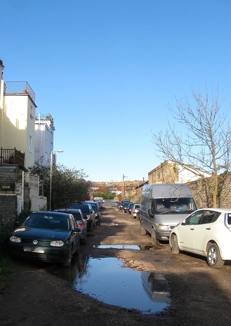
Image: © Simon Carey Taken: 13 Nov 2015
An unmade road that ran between Marine Parade and Roedean Road though access to the former has now been blocked. As the name suggests the road follows the old eastern parish boundary with Rottingdean. The old boundary disappeared in 1928 when the borough council absorbed neighbouring Rottingdean and Ovingdean parishes. To the left are the rear of houses in Arundel Street whilst beyond the flint wall to the right is an area once occupied by Black Rock Gas Works.
Images are licensed for reuse under creativecommons.org/licenses/by-sa/2.0
Image Location
Latitude
50.816207
Longitude
-0.106156