Walled-up railway bridge, Thongsbridge
Introduction
The photograph on this page of Walled-up railway bridge, Thongsbridge by Humphrey Bolton as part of the Geograph project.
The Geograph project started in 2005 with the aim of publishing, organising and preserving representative images for every square kilometre of Great Britain, Ireland and the Isle of Man.

There are currently over 7.5m images from over 14,400 individuals and you can help contribute to the project by visiting https://www.geograph.org.uk
Walled-up railway bridge, Thongsbridge
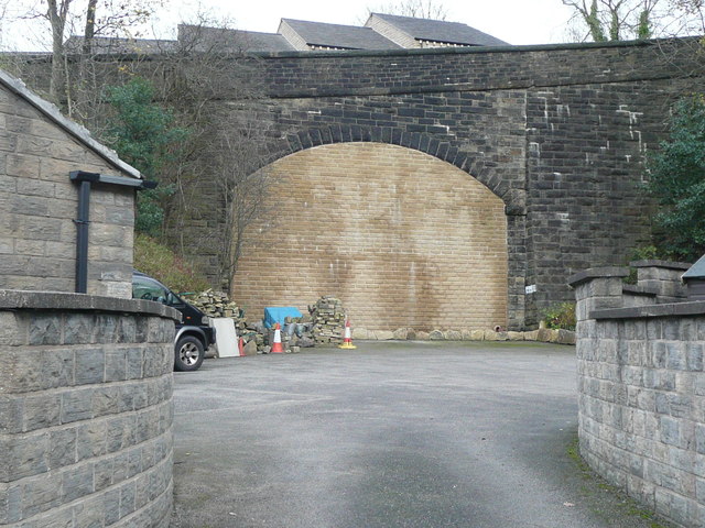
Image: © Humphrey Bolton Taken: 11 Nov 2015
This came as a surprise, as I had forgotten that Holmfirth had a railway, a branch of the Lancashire and Yorkshire Railway in 1893, but of the Huddersfield and Sheffield Junction Railway in 1850. Presumably the route along the valley was too difficult because of mills, so that the line had to climb steeply out of Holmfirth up to this bridge under Heys Road. Thongsbridge station was on the other side, and the OS map still shows a wooded area with two lines that might be the edges of the platforms. However, there is a building site there now - you can see the roofs of the new houses. The line continued over a high viaduct and along the eastern hillside on the Holme valley.
Images are licensed for reuse under creativecommons.org/licenses/by-sa/2.0
Image Location
Latitude
53.583945
Longitude
-1.773538